File:The West London Line (geograph 3420713).jpg
Size of this preview: 800 × 536 pixels. Other resolutions: 320 × 214 pixels | 640 × 429 pixels | 1,024 × 686 pixels | 1,280 × 858 pixels | 1,600 × 1,072 pixels.
Original file (1,600 × 1,072 pixels, file size: 1.5 MB, MIME type: image/jpeg)
Summary
| Description |
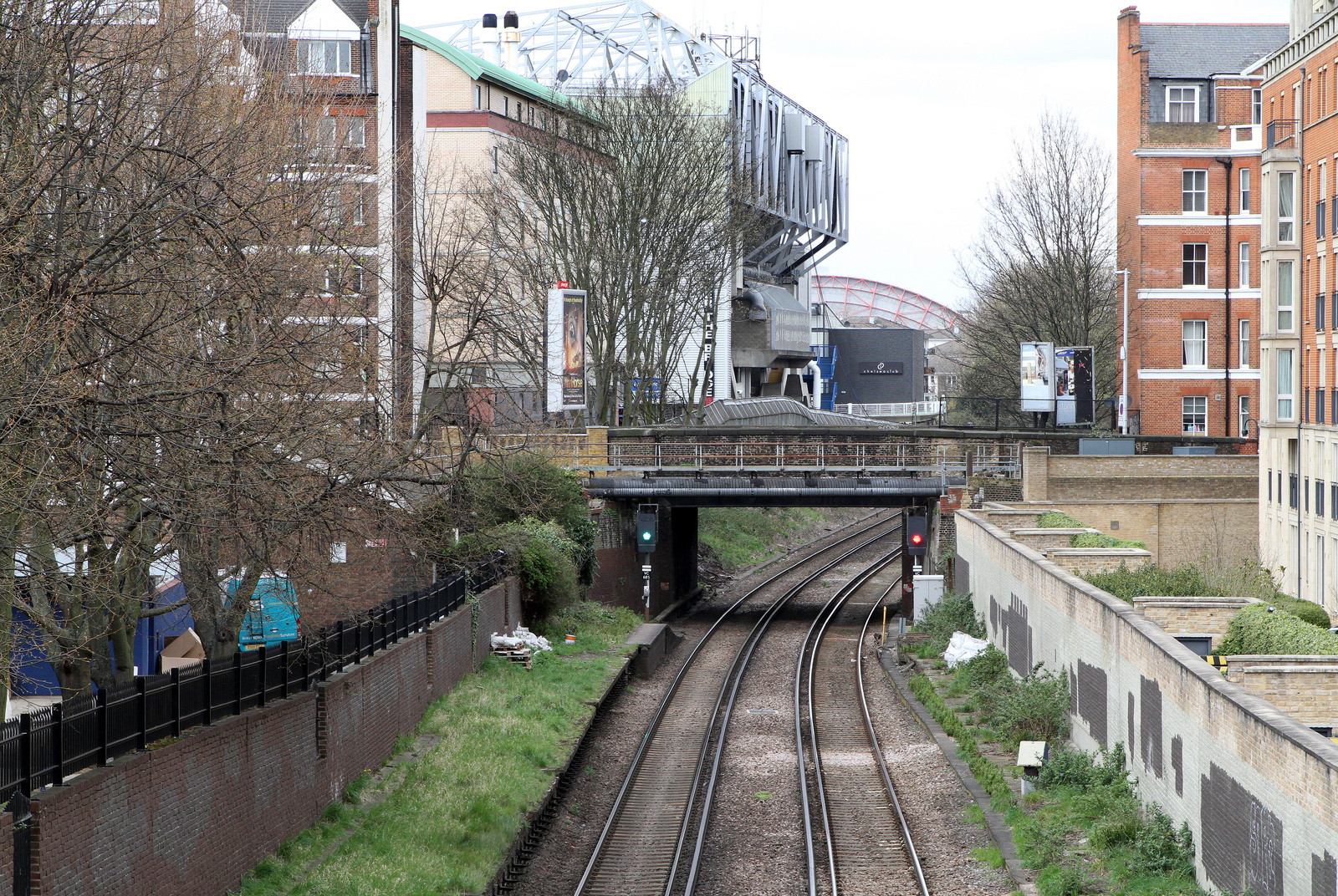
English: The West London Line The railway line connecting Willesden Junction with Clapham Junction. This section of the line was constructed as the West London Extension Joint Railway in 1863. This view is from King's Road. The bridge in the middle distance carries Fulham Road over the tracks. Beyond the bridge, Chelsea's Stamford Bridge stadium can be seen to the left of the tracks. In the distance is one of Earl's Court's exhibition halls. |
| Date | |
| Source | From geograph.org.uk |
| Author | Martin Addison |
| Permission (Reusing this file) |
Creative Commons Attribution Share-alike license 2.0 |
| Attribution (required by the license) | Martin Addison / The West London Line / |
| Camera location | | View this and other nearby images on: OpenStreetMap |
|---|
.jpg¶ms=051.479732_N_-000.186953_E_globe:Earth_type:camera_heading:315.00_source:geograph&language=en)
| Object location | | View this and other nearby images on: OpenStreetMap |
|---|
.jpg¶ms=051.480690_N_-000.188100_E_globe:Earth_class:object_type:object_source:geograph-osgb36(TQ25917730)_region:GB-GBN_heading:315.00&language=en)
Licensing

|
This image was taken from the Geograph project collection. See this photograph's page on the Geograph website for the photographer's contact details. The copyright on this image is owned by Martin Addison and is licensed for reuse under the Creative Commons Attribution-ShareAlike 2.0 license.
|
This file is licensed under the Creative Commons Attribution-Share Alike 2.0 Generic license.
Attribution: Martin Addison
- You are free:
- to share – to copy, distribute and transmit the work
- to remix – to adapt the work
- Under the following conditions:
- attribution – You must give appropriate credit, provide a link to the license, and indicate if changes were made. You may do so in any reasonable manner, but not in any way that suggests the licensor endorses you or your use.
- share alike – If you remix, transform, or build upon the material, you must distribute your contributions under the same or compatible license as the original.
File history
Click on a date/time to view the file as it appeared at that time.
| Date/Time | Thumbnail | Dimensions | User | Comment | |
|---|---|---|---|---|---|
| current | 16:16, 28 June 2013 | | 1,600 × 1,072 (1.5 MB) | File Upload Bot (Magnus Manske) | Transferred from Geograph by User:cnbrb |
File usage
The following 2 pages use this file:
Global file usage
The following other wikis use this file:
- Usage on fa.wikipedia.org
- Usage on www.wikidata.org