File:Monmouth Monnow Bridge cropped.jpg
Size of this preview: 793 × 599 pixels. Other resolutions: 318 × 240 pixels | 635 × 480 pixels | 963 × 728 pixels.
Original file (963 × 728 pixels, file size: 564 KB, MIME type: image/jpeg)
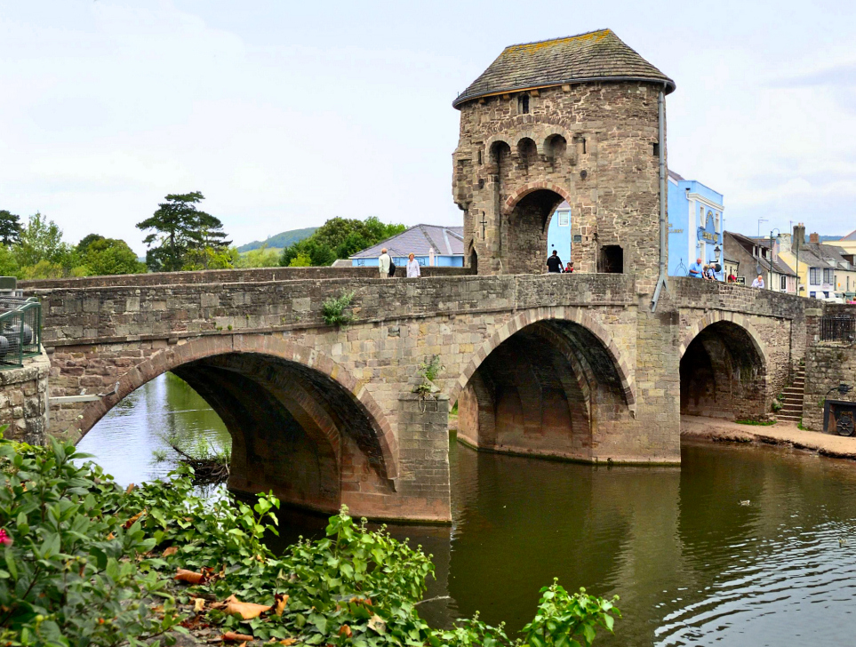
| Description | Monnow Bridge is a medieval bridge over the namesake river Monnow in the town of Monmouth, Wales. The existing bridge was completed in the late 13th century. It is the only remaining medieval fortified bridge in Britain. | ||
| Date | |||
| Source | Flickr: Monmouth - Monnow Bridge | ||
| Author | Bob Crowther | ||
| Permission (Reusing this file) |
This file is licensed under the Creative Commons Attribution 2.0 Generic license.
|
||
| Other versions |

| Camera location | | View this and other nearby images on: OpenStreetMap |
|---|

|
This image has been assessed under the valued image criteria and is considered the most valued image on Commons within the scope: Monnow Bridge, Monmouth. You can see its nomination here. |
File history
Click on a date/time to view the file as it appeared at that time.
| Date/Time | Thumbnail | Dimensions | User | Comment | |
|---|---|---|---|---|---|
| current | 21:06, 5 June 2012 | | 963 × 728 (564 KB) | AxelHH | {{Information |Description ={{de|1=dfsf}} |Source ={{own}} |Author =AxelHH |Date = |Permission = |other_versions = }} |
File usage
The following 3 pages use this file:
Global file usage
The following other wikis use this file:
- Usage on cy.wikipedia.org
- Usage on de.wikipedia.org
- Usage on en.wiktionary.org
- Usage on es.wikipedia.org
- Usage on fi.wikipedia.org