File:Map-kommunur-foroya-2009.png
Size of this preview: 450 × 600 pixels. Other resolutions: 180 × 240 pixels | 600 × 800 pixels.
Original file (600 × 800 pixels, file size: 57 KB, MIME type: image/png)
Summary
| Description |
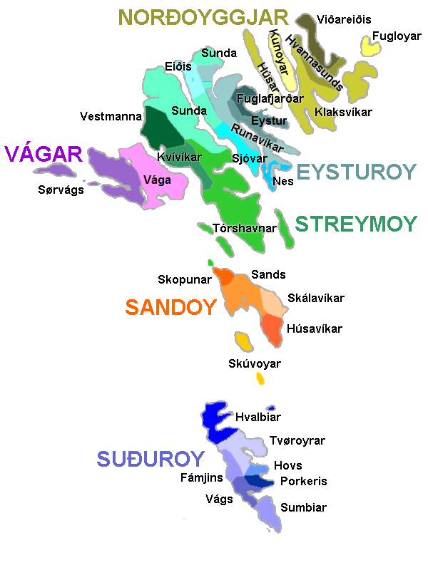
English: Map of the municipalities of the Faroe Islands, as of January 1, 2009.
Norsk bokmål: Kart over kommunene på Færøyene av 1. januar 2009.
Føroyskt: Kort yvir kommununum í Føroyum síðan 1. januar 2009. |
| Date | |
| Source | Own work |
| Author | Erik Fløan |
| Other versions | 2005 edition |
Licensing
| I, the copyright holder of this work, release this work into the public domain. This applies worldwide. In some countries this may not be legally possible; if so: I grant anyone the right to use this work for any purpose, without any conditions, unless such conditions are required by law. |
File history
Click on a date/time to view the file as it appeared at that time.
| Date/Time | Thumbnail | Dimensions | User | Comment | |
|---|---|---|---|---|---|
| current | 16:44, 6 January 2009 | | 600 × 800 (57 KB) | Efloean | {{Information |Description={{en|1=Map of the municipalities of the Faroe Islands, as of January 1, 2009.}} {{no|1=Kart over kommunene på Færøyene av 1. januar 2009.}} {{fo|1=Kort yvir kommununum í Føroyum síðan 1. januar 2009.}} |Source=Own work |A |
| 16:39, 6 January 2009 |  | 600 × 800 (57 KB) | Efloean | {{Information |Description={{en|1=Map of the municipalities of the Faroe Islands, as of January 1, 2009.}} {{no|1=Kart over kommunene på Færøyene av 1. januar 2009.}} {{fo|1=Kort yvir kommunur Føroya síðan 1. januar 2009.}} |Source=Own work |Author= |
File usage
The following page uses this file:
Global file usage
The following other wikis use this file:
- Usage on da.wikipedia.org
- Usage on de.wikipedia.org
- Usage on en.wiktionary.org
- Usage on eu.wikipedia.org
- Usage on fi.wikipedia.org
- Usage on hu.wikipedia.org
- Usage on lt.wikipedia.org
- Usage on no.wikipedia.org
- Usage on pl.wikipedia.org
View more global usage of this file.