File:Cullompton station geograph-3092351-by-Ben-Brooksbank.jpg

Size of this preview: 800 × 449 pixels. Other resolutions: 320 × 180 pixels | 640 × 359 pixels | 898 × 504 pixels.
Original file (898 × 504 pixels, file size: 409 KB, MIME type: image/jpeg)
Summary
| Description |
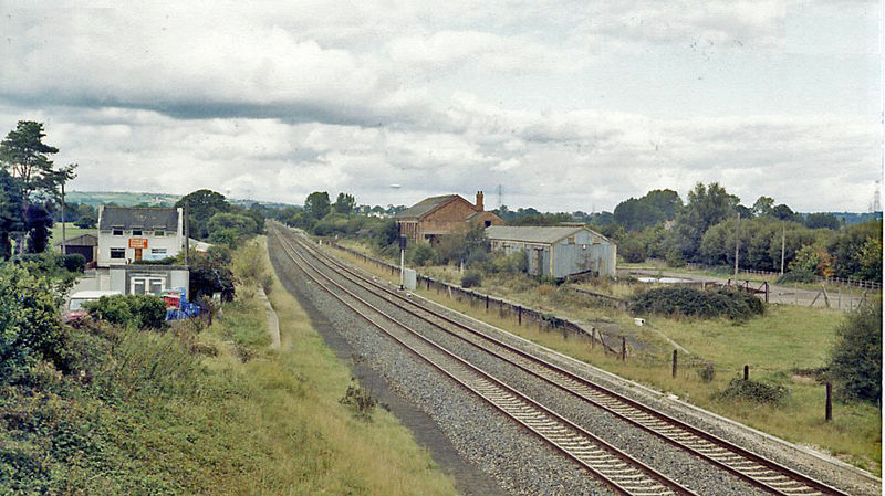
English: Site of Cullompton station. View northward from the A38 bridge, towards Taunton and Bristol/London: ex-GWR Taunton etc. - Exeter etc. trunk line. The station was closed 5/10/64 (goods 8/5/67), but this main line remains - even if the M5 beside it takes much of the West Country traffic. |
| Date | |
| Source | From geograph.org.uk |
| Author | Ben Brooksbank |
| Permission (Reusing this file) |
Creative Commons Attribution Share-alike license 2.0 |
| Attribution (required by the license) | Ben Brooksbank / Site of Cullompton station / |
| Camera location | | View this and other nearby images on: OpenStreetMap |
|---|
Licensing

|
This image was taken from the Geograph project collection. See this photograph's page on the Geograph website for the photographer's contact details. The copyright on this image is owned by Ben Brooksbank and is licensed for reuse under the Creative Commons Attribution-ShareAlike 2.0 license.
|
This file is licensed under the Creative Commons Attribution-Share Alike 2.0 Generic license.
Attribution: Ben Brooksbank
- You are free:
- to share – to copy, distribute and transmit the work
- to remix – to adapt the work
- Under the following conditions:
- attribution – You must give appropriate credit, provide a link to the license, and indicate if changes were made. You may do so in any reasonable manner, but not in any way that suggests the licensor endorses you or your use.
- share alike – If you remix, transform, or build upon the material, you must distribute your contributions under the same or compatible license as the original.
File history
Click on a date/time to view the file as it appeared at that time.
| Date/Time | Thumbnail | Dimensions | User | Comment | |
|---|---|---|---|---|---|
| current | 12:56, 2 September 2012 | | 898 × 504 (409 KB) | Chevin | == {{int:filedesc}} == {{Information |Description={{en|1='''Site of Cullompton station.'''<br/> View northward from the A38 bridge, towards Taunton and Bristol/London: ex-GWR Taunton etc. - Exeter etc. trunk line. The station was closed 5/10/64 (goods ... |
File usage
The following page uses this file: