File:Thorney RD 1935.png
Size of this preview: 600 × 599 pixels. Other resolutions: 240 × 240 pixels | 481 × 480 pixels | 769 × 768 pixels | 1,025 × 1,024 pixels | 1,470 × 1,468 pixels.
Original file (1,470 × 1,468 pixels, file size: 42 KB, MIME type: image/png)
| Description |
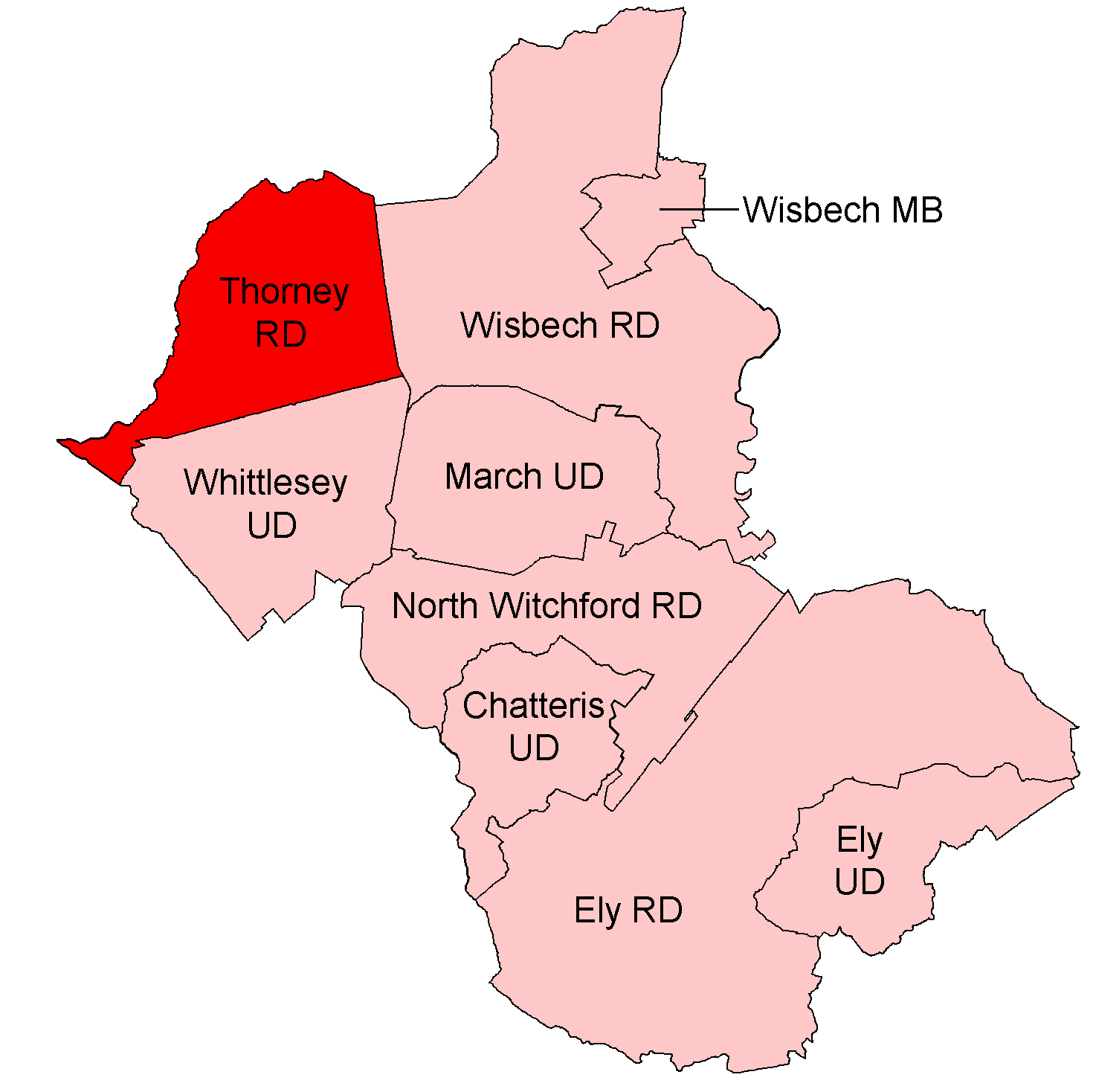
English: Thorney Rural District, shown within the administrative county of the Isle of Ely.
All boundaries shown are correct from 1935 to 1960. Thorney RD itself was unchanged between 1933 and abolition in 1974. |
| Date | |
| Source |
Districts built up from parishes as cited at w:Civil parishes in Cambridgeshire. Modern parish boundaries from Ordnance Survey Boundary-Line datasets licensed under the Open Government Licence v1.0. Historic boundaries, where different, from copyright-expired Provisional/First Edition 1:25,000. |
| Author | Keith Edkins |
| Permission (Reusing this file) |
This file is licensed under the Creative Commons Attribution-Share Alike 4.0 International license.
|
File history
Click on a date/time to view the file as it appeared at that time.
| Date/Time | Thumbnail | Dimensions | User | Comment | |
|---|---|---|---|---|---|
| current | 22:40, 9 June 2017 | | 1,470 × 1,468 (42 KB) | Keith Edkins | |
| 20:50, 9 June 2017 |  | 1,470 × 1,468 (42 KB) | Keith Edkins | {{Information |Description={{en|Thorney Rural District, shown within the administrative county of the Isle of Ely. All boundaries shown are correct from 1935 to 1960. Thorney RD itself was unchanged between 1933 and abolition in 1974.}} |Source=Dist... |
File usage
The following page uses this file: