File:Gribbin Tower - geograph.org.uk - 1239648.jpg
Size of this preview: 450 × 600 pixels. Other resolutions: 180 × 240 pixels | 480 × 640 pixels.
Original file (480 × 640 pixels, file size: 28 KB, MIME type: image/jpeg)
Summary
| Description |
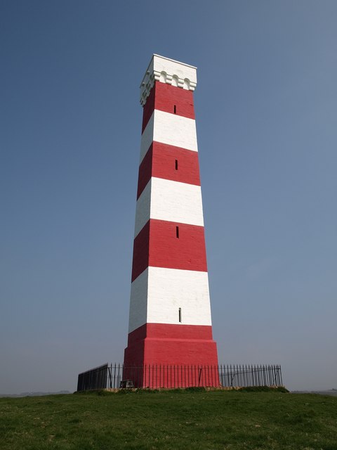
English: Gribbin Tower. Another view of 29711. The day navigation beacon is described at https://historicengland.org.uk/listing/the-list/list-entry/1210498 as "very tall"! Other sources agree it is 84 feet high. |
| Date | |
| Source | From geograph.org.uk |
| Author | Derek Harper |
| Attribution (required by the license) | Derek Harper / Gribbin Tower / |
| Camera location | | View this and other nearby images on: OpenStreetMap |
|---|
_heading:45.00&language=en)
| Object location | | View this and other nearby images on: OpenStreetMap |
|---|
_heading:45.00&language=en)
Licensing

|
This image was taken from the Geograph project collection. See this photograph's page on the Geograph website for the photographer's contact details. The copyright on this image is owned by Derek Harper and is licensed for reuse under the Creative Commons Attribution-ShareAlike 2.0 license.
|
This file is licensed under the Creative Commons Attribution-Share Alike 2.0 Generic license.
Attribution: Derek Harper
- You are free:
- to share – to copy, distribute and transmit the work
- to remix – to adapt the work
- Under the following conditions:
- attribution – You must give appropriate credit, provide a link to the license, and indicate if changes were made. You may do so in any reasonable manner, but not in any way that suggests the licensor endorses you or your use.
- share alike – If you remix, transform, or build upon the material, you must distribute your contributions under the same or compatible license as the original.
File history
Click on a date/time to view the file as it appeared at that time.
| Date/Time | Thumbnail | Dimensions | User | Comment | |
|---|---|---|---|---|---|
| current | 13:19, 26 February 2011 | | 480 × 640 (28 KB) | GeographBot | == {{int:filedesc}} == {{Information |description={{en|1=Gribbin Tower Another view of 29711. The day navigation beacon is described at http://www.imagesofengland.org.uk/Details/Default.aspx?id=395103&mode=adv as "very tall"! Other sources agree it is |
File usage
The following 2 pages use this file:
Global file usage
The following other wikis use this file:
- Usage on he.wikipedia.org